World Map
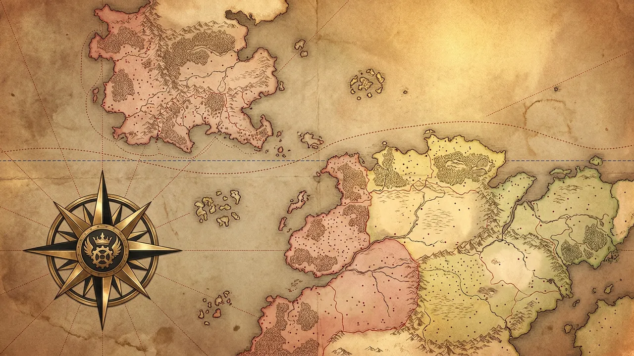
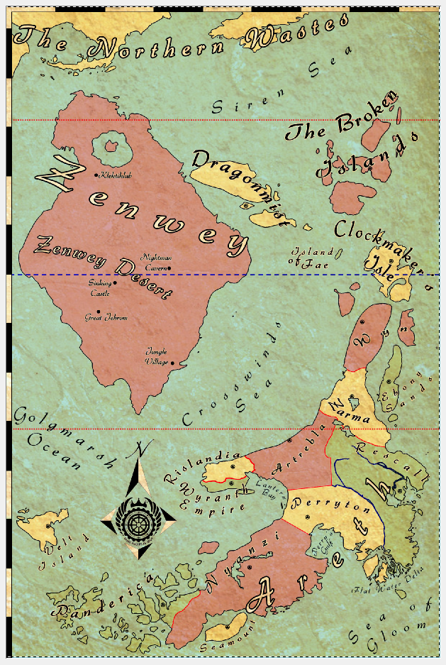
The official world map of the Adventures of Baron Von Monocle shows two continents, Areth and Zenwey, with the island groups and seas around them. Regions are tinted red, yellow or green, and dots mark cities. A compass rose with a winged-gear emblem sits in the western ocean. The map was drawn for the series, and this page lists every label on it. Labels are spelled exactly as printed.
Gazetteer
The north
- The Northern Wastes: yellow land along the top edge of the map. See Northern Wastes.
- Siren Sea: the sea below the Wastes. See Siren Sea.
- The Broken Islands: a cluster of red islands in the north-east. See Broken Islands.
Zenwey (red continent, north-west)
- Zenwey: the large red continent. See Zenwey.
- Zenwey Desert: a label across the centre of the continent. See Zenwey Desert.
- An unnamed lake with an island in it, in the north of the continent.
- City dots, from north to south:
- Klektiklub: north-west. See Klektiklab.
- Nightman Cavern: east-centre. See Nightmen City.
- Sinking Castle: centre-west. See Juiyan's Castle.
- Great Jehrom: south-centre. See Great Jerohm.
- Jungle Village: south-east coast. See Jungle Village.
Islands between the continents
- Dragonmist: yellow islands east of Zenwey, with a city dot. See Dragonmist Isles.
- Island of Fae: one small island in the eastern sea. See Islands of Fae.
- Clockmaker's Isle: yellow islands in the east, with a city dot. See Clockmaker's Isle.
- Crosswinds Sea: the sea between Zenwey and Areth. See Crosswinds Sea.
Areth (south and east)
- Areth: the continent name, printed in giant letters across the south-east. See Areth.
- Wyn: red land at the north-east tip, plus an island to its east. See Wyn.
- Zarma: yellow, south of Wyn, with a lake and a city dot. See Zarma.
- Ebony Sands: a green island east of Zarma, with a city dot. See Ebony Sands Coast.
- Rislandia: yellow, at the north-west tip of Areth, with a city dot. A red line marks its southern border. See Rislandia and Border River.
- Wyranth Empire: green, directly south of Rislandia on the same peninsula, with a city dot. See Wyranth Empire and Rislandia-Wyranth Peninsula.
- Lantern Bay: the bay east of the peninsula. See Lantern Bay.
- Artrebla: red, east of Rislandia, with a city dot on its north coast. The printed spelling is "Artrebla"; the books spell it Atrebla.
- Perryton: yellow, south of Artrebla, with a city dot. See Perryton.
- Perry's Gulf: the gulf south of Perryton. See Perry's Gulf.
- Rescall: green, in the east, crossed by blue rivers, with a city dot near the east coast. See Rescall.
- Flat Water Delta: a river delta on the south-east coast. See Flat Water Delta.
- Nyanzi: a long red landmass in the south-west, with a city dot. See Nyanzi.
- Seamount: a yellow island off Nyanzi's southern tip, with a city dot. See Seamount.
- Panderica: a green archipelago in the south-west, with a city dot. See Panderica.
Western and southern waters
- Golgmarsh Ocean: the ocean west of Areth and south of Zenwey. See Golgmarsh Ocean.
- Velt Island: a yellow island in the far west, with a city dot. See Velt Island.
- Sea of Gloom: the sea in the south-east corner. See Sea of Gloom.
Map features
- Compass rose: an eight-point brass-and-black star marked "N", placed in the Golgmarsh Ocean. Its centre holds a crowned, winged gear-wheel emblem. The small lettering around the emblem cannot be read at the map's resolution.
- Lines: two red dotted lines run across the whole map, one through the Siren Sea and one through northern Areth (Zarma and the Golgmarsh Ocean). A blue dashed line crosses the middle of the map, through southern Zenwey and Clockmaker's Isle. The map does not explain these lines.
- Borders: red lines separate the nations of Areth. A thin line separates Rislandia from the Wyranth Empire.
- Unlabelled city dots: every region has a city dot, but no city is named. Rislandia City, Portsgate and Wyranth's capital are not identified.
Places in the books that are not on the map
- Zicree Continent. The Steam Knight places it across the Golgmarsh Ocean.
- Tyndree Kingdom, absorbed into the Wyranth Empire.
- Oler Mountains, Mitis Mountain Range, Artacala Desert (perhaps the map's "Zenwey Desert"), and the Zenwey volcano.
- Every city and town of Rislandia and Wyranth.
Differences between the map and the texts
These are listed for the author to rule on. The wiki has not resolved them.
- The map prints Artrebla; every text has Atrebla.
- The map prints Klektiklub; The Blood of Giants has Klektiklab.
- The map prints Great Jehrom; The Blood of Giants has Great Jerohm.
- The map puts Ebony Sands on an island off Zarma in Areth. In The Blood of Giants, the Ebony Sands Coast is on Zenwey, where the Liliana lands below a volcano.
- The map shows one Island of Fae between Zenwey and Clockmaker's Isle. The wiki's Islands of Fae page places them in the western Golgmarsh Ocean.
- The Rislandia page says the Golgmarsh Ocean lies west and north of the kingdom. On the map, the water north of Rislandia is labelled Crosswinds Sea.
- In The Blood of Giants, Great Jerohm is reached travelling along Zenwey's northern coast. On the map it sits in the south of the continent.