Minor Places of Rislandia (A History of Rislandia)
According to A History of Rislandia, the kingdom of Rislandia contained a great many settlements, geographic features, and points of infrastructure beyond its principal cities. The sourcebook records these places in varying degrees of detail, from brief identifying phrases to fuller descriptive passages. What follows is a systematic catalogue of those minor places as the text presents them, organised by region.
Overview
The minor places of Rislandia collectively illustrate the kingdom's economic diversity and strategic concerns. Timber, mining, salt production, shipbuilding, fishing, and overland trade each found expression in distinct communities scattered across the kingdom's forests, mountains, coasts, and borderlands. Roads, rivers, and passes tied these communities to the capital and to one another, while fortified posts guarded the routes most vulnerable to foreign incursion.
The Old Forest Region
Bridgefield
Makersville
Makersville was described as "a village on the northern edge of the Old Forest, home to craftsmen and artisans." Its situation on the forest's northern fringe distinguished it from Bridgefield, and its population of skilled makers suggests it served as a centre of small-scale manufacture drawing on forest materials.
Hunter's Trails
The sourcebook noted the existence of Hunter's Trails within the Old Forest: paths used by trappers and woodsmen moving through the interior. These routes were not formally maintained roads but practical working paths worn by regular use.
The Oler Mountains Region
Highstone
According to A History of Rislandia, Highstone was "a mining town in the Oler Mountains, producing iron and copper." It represented one of the kingdom's principal sources of base metals within that range.
Sandford
Sandford was recorded as "a border trading post near the Atrebla Kingdom," situated in the Oler Mountains close to Atrebla. Its function was commercial rather than purely military, facilitating exchange between Rislandia and its neighbour.
Brighton
Brighton was described as "a fortified town near Oler Pass, guarding the route to Atrebla." Unlike Sandford, Brighton's character was primarily defensive, controlling access through the pass.
Sanrel Mountains
The sourcebook identified the Sanrel Mountains as the northern extension of the Oler Mountains range. No settlements within the Sanrel Mountains were described in the passages recorded here.
High Peaks
The High Peaks were noted as unexplored summits within the Oler Mountains, possibly hiding ancient ruins. The sourcebook offered no further detail, leaving their contents a matter of speculation.
The Western Coast
Cliffside
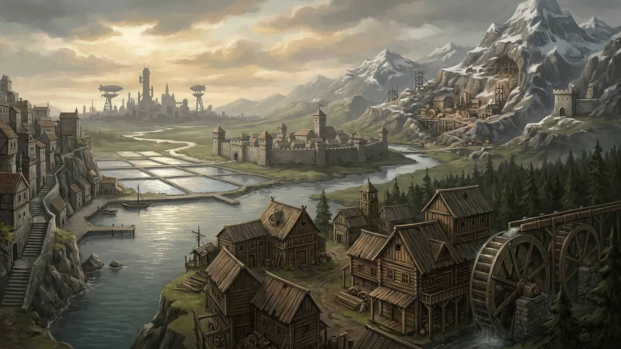
According to A History of Rislandia, Cliffside was "a town built into coastal cliffs, accessible only by steep stairs or boat." The sourcebook explicitly distinguished this settlement from Cliffside Castle, treating them as separate places.
Saltston
Saltston was described as "a coastal town that produces salt through evaporation ponds." Its industry made it a supplier of a commodity essential to preservation and trade throughout the kingdom.
Traveler's Rest
Traveler's Rest was recorded as "a coastal inn and waystation, popular with sailors and travelers." Its function was hospitality and resupply rather than production or defence.
Saro's Rest
The sourcebook described Saro's Rest as "a coastal location, possibly a lighthouse or waystation." The hedged phrasing suggests the scholarly author was uncertain of its precise function.
Coastal Road
The Coastal Road ran along the western coast, connecting Portsgate, Shellville, and other coastal towns. It served as the primary overland artery linking the western littoral communities.
The Eastern Coast and Lantern Bay
Kingsfort
According to A History of Rislandia, Kingsfort was "a fortified port city on the eastern coast, home to a naval base," facing Lantern Bay. Its dual character as both port and military installation made it the most strategically significant of the eastern coastal settlements catalogued here.
Markfort
Markfort was described as "a trading town on the eastern coast, connecting to distant lands," also situated on Lantern Bay. Its commercial orientation complemented Kingsfort's military one.
Shipyard Marsh
Shipyard Marsh was recorded as "a shipbuilding center on the eastern coast, producing naval vessels." Together with Kingsfort and Markfort, it formed part of a cluster of eastern coastal communities oriented toward maritime activity on Lantern Bay.
Alwin Clops Village
Alwin Clops Village was described simply as "a fishing village on the eastern coast" facing Lantern Bay. The sourcebook offered no further elaboration.
Eastern Road
The Eastern Road connected Rislandia City to Cliffside Castle and the eastern coast, providing the principal overland link between the capital and the Lantern Bay settlements.
The Tilway River and Its Valley
Tilway River
According to A History of Rislandia, the Tilway River was "a smaller river in the eastern part of Rislandia, flowing from the Oler Mountains to Lantern Bay." The sourcebook noted it was narrower and faster than the Grune River, flowed through heavily forested terrain, and was used by logging operations to float timber downstream. The river valley was described as less populated than the Grune valley.
Twin Lakes
The Twin Lakes were two connected lakes fed by the Tilway River, described as popular for fishing and recreation.
Swantown
Swantown was recorded as "a small riverside village on the Tilway River," with no further detail provided in the passages noted here.
The Central Heartland
River's Crossing
According to A History of Rislandia, River's Crossing was "a town where a major road crosses the Tilway River," identified as a key location in the Central Heartland of Rislandia. Its importance derived from its function as a crossing point on a principal route.
Urubury
Urubury was described as "a river town on the Grune River, known for its mills." Its milling industry placed it among the kingdom's inland processing centres.
The Southern Borderlands
Borderville
According to A History of Rislandia, Borderville was "a fortified border town near the Border River." Its fortified character reflected the strategic sensitivity of the southern frontier.
Southern Dale
Southern Dale was described as "a farming community in the southern borderlands," providing agricultural production in a region otherwise characterised by military installations.
Okin Mines
Okin Mines was recorded as "a mining town near the Wyranth Mountains, producing iron and coal." The sourcebook placed it in the Southern Borderlands of Rislandia.
Border Road
The Border Road ran parallel to the Border River, connecting fortified towns and military outposts along the southern frontier.
The Wyranth Mountains (Rislandian Side)
Wyranth Mountains
The sourcebook mentioned the Wyranth Mountains as a geographic feature in central-southern Rislandia. According to A History of Rislandia, the Oler Mountains were described as taller and more rugged than the Wyranth Mountains. The Wyranth Mountains fed rivers into Lake Bethany, and the Border River flowed from them to the Golgmarsh Ocean. The Mountain Road ran through them connecting to Pleasant Pass and Desert's Watch.
Mountain Road
The Mountain Road ran through the Wyranth Mountains, connecting to Pleasant Pass and Desert's Watch.
Wild Peaks
The Wild Peaks were described as unexplored mountains within the southern Westerly Spine, rumoured to hide Giant ruins or worse. The sourcebook offered no further confirmed detail.
The Westerly Spine Passages
Traveler's Fort
According to A History of Rislandia, Traveler's Fort guarded the western entrance of Pleasant Pass and was described as "the southernmost Rislandian holding on the western side of the Westerly Spine."
Pleasant Pass Fort
Pleasant Pass Fort controlled the highest point of Pleasant Pass through the Westerly Spine.
Northern Forest Route
The Northern Forest Route was described as "a dangerous, unmaintained path used primarily by smugglers, outlaws, and desperate travelers" skirting the northern end of the Westerly Spine through the Old Forest. According to the sourcebook, it added five to seven days to a journey compared to Pleasant Pass and was fraught with dangers including were-creatures, giant bats, bandits, the Fae, and the risk of becoming lost. The route was known but not officially maintained or patrolled.
Rislandia City: Minor Internal Locations
Knights' Courtyard
According to A History of Rislandia, the Knights' Courtyard surrounded the Crystal Spire in Rislandia City and was the place where the Knights of the Crystal Spire trained.
Airship Landing Pad
The Airship Landing Pad was located on the outskirts of Rislandia City. The sourcebook described it as "a large, flat area on the city's outskirts," equipped with mooring towers, fuel depots, and repair facilities. The Liliana and other airships launched from this location. It was guarded by soldiers and anti-sabotage measures.
Grand Market
The Grand Market was held every seventh day in the Merchant Quarter of Rislandia City. According to the sourcebook, it drew traders from across the kingdom and sold exotic items from Zenwey, Nyanzi, and other lands, and featured street performers, food vendors, and pickpockets.
Other Notable Minor Places
Loveridge Inn
The Loveridge Inn, located in Loveridge, was described as "a famous gathering place for soldiers and travelers."
Symphonic House Dome
The Symphonic House Dome was a concert hall in Portsgate, described in the sourcebook as "the city's pride." According to A History of Rislandia, it was reduced to rubble by Wyranth forces during the destruction of Portsgate. A known page exists for this location under the slug symphonic-house-portsgate.